

Frontier Fortresses & Southern Kingdoms
Dimasa Kachari Royal Citadels of Khaspur & Maibang, Tezpur Shakta-Shaiva Bastions, Jogighopa Rock Caves, Gupta Kashi Biswanath & Ahom Military Highways (8th–19th Century CE)
Curated by The Archival Commons • Permanent Collection • Echo Digital Museum
Historical Background & Architectural Context
Curatorial dossier of the royal citadels, monolithic rock-cut shrines, frontier river forts, and military embankment highways spanning the southern Dimasa Kachari Kingdom (Dima Hasao and Cachar), the northern Brahmaputra bastions of Sonitpur and Biswanath, the western rock caves of Jogighopa, and the trans-valley Ahom Garh-Ali network. Anchored to Archaeological Survey of India (ASI Guwahati Circle Monument Codes N-AS-1 through N-AS-7, N-AS-50, and N-AS-65), Directorate of Archaeology (Government of Assam) statutory registers, Dr. S.K. Bhuyan's Kachari Buranji (1936), and Dr. Maheswar Neog's Prachya-Sasanavali (1974).
This curated exhibition forms an integral part of Echo — India's living cultural digital museum curated by Paper Umbrella Studios in Jorhat, Assam. The monuments and sacred structures documented in this collection showcase the remarkable architectural ingenuity of Assam's historic builders, who engineered enduring brick citadels, rock-cut shrines, and timber prayer sanctums designed to withstand the rigorous monsoon flooding and seismic shifts of the Brahmaputra valley.
From the specialized organic mortars utilizing indigenous sticky bora rice, duck eggs, and snail lime to the sacred geometrical alignment of sanctum sanctorums, each exhibit preserves irreplaceable civilizational memory. Every artifact in this collection has been documented with verified provenance citations, high-resolution photography, and ethnographic notes to safeguard regional heritage for posterity.
Curated Artifacts & Architectural Elements (8 Items)
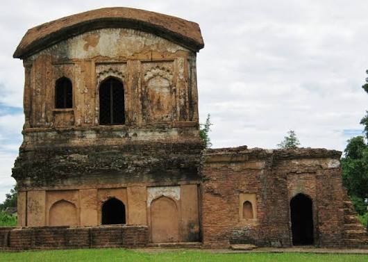
Khaspur Dimasa Kachari Royal Palace Ruins (খছপুৰৰ ডিমাছা কছাৰী ৰাজপ্ৰাসাদ ভগ্নাৱশেষ)
Eighteenth-Century Dimasa Kachari Royal Citadel, Singhaduar Lion Gate, Snan Mandir & Ranachandi Temple in Cachar (ASI Codes N-AS-1 to N-AS-6)
Eighteenth-Century Dimasa Kachari Royal Citadel, Singhaduar Lion Gate, Snan Mandir & Ranachandi Temple in Cachar (ASI Codes N-AS-1 to N-AS-6)
Khaspur Dimasa Kachari Royal Palace Ruins (খছপুৰৰ ডিমাছা কছাৰী ৰাজপ্ৰাসাদ ভগ্নাৱশেষ) (Khaspur (Silchar), Cachar District, Assam)
Maibang Monolithic Rock-Cut Temple / Ekashila Mandir (মাইবঙৰ একশিলা শৈল মন্দিৰ)
1721 CE Dimasa Kachari Monolithic Do-Chala Sandstone Temple on the Mahur River by King Harishchandra Narayana (ASI Code N-AS-7)
1721 CE Dimasa Kachari Monolithic Do-Chala Sandstone Temple on the Mahur River by King Harishchandra Narayana (ASI Code N-AS-7)
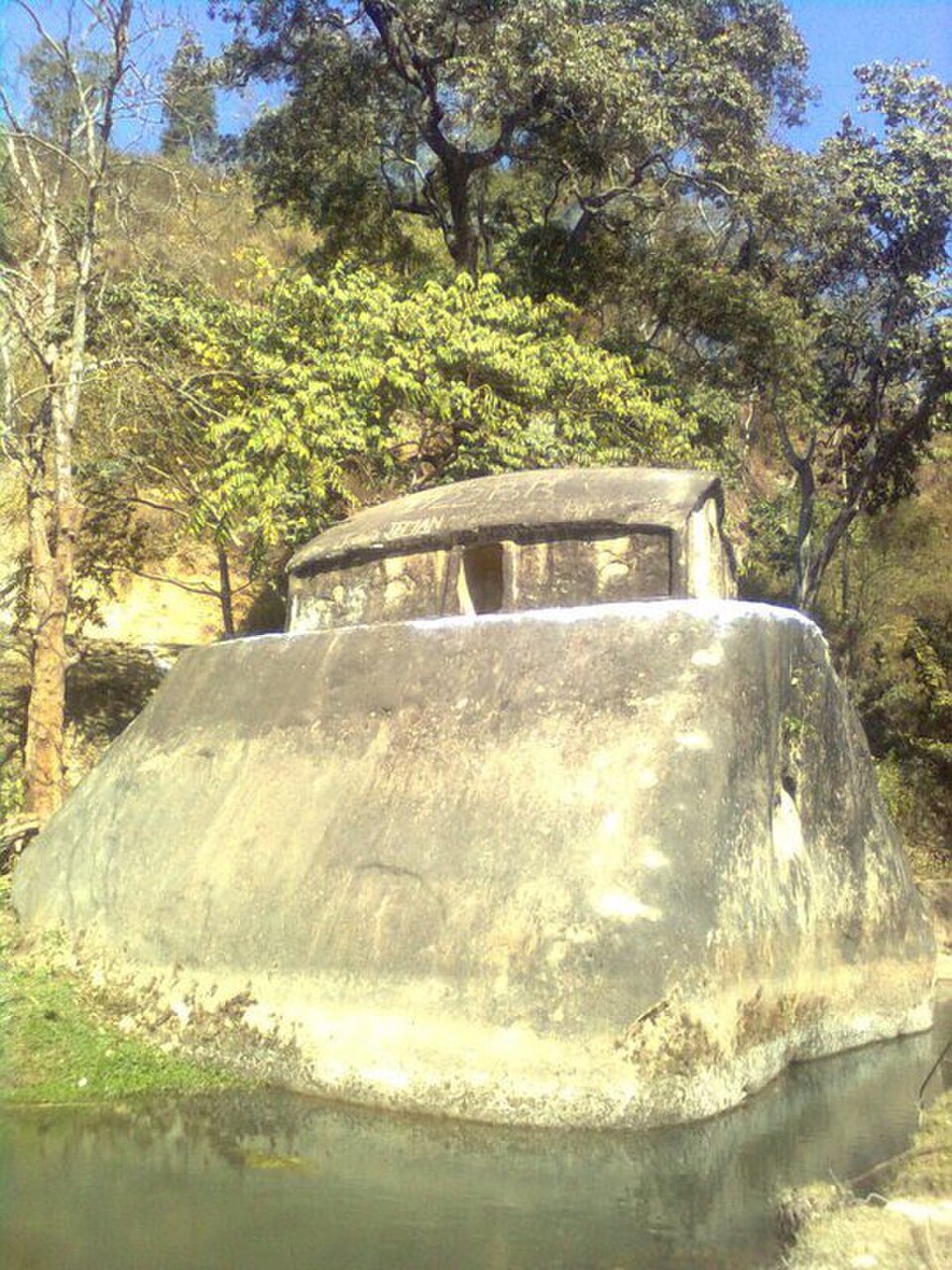
Maibang Monolithic Rock-Cut Temple / Ekashila Mandir (মাইবঙৰ একশিলা শৈল মন্দিৰ) (Maibang, Dima Hasao (North Cachar Hills) District, Assam)
Bhairabi Devalaya of Tezpur (ভৈৰৱী দেৱালয়, তেজপুৰ)
Ancient Shakta Peetha & Late Medieval Multi-Faceted Brick Shikhara Overlooking the Brahmaputra at Bamuni-Majgaon, Tezpur
Ancient Shakta Peetha & Late Medieval Multi-Faceted Brick Shikhara Overlooking the Brahmaputra at Bamuni-Majgaon, Tezpur
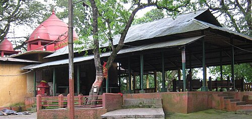
Bhairabi Devalaya of Tezpur (ভৈৰৱী দেৱালয়, তেজপুৰ) (Bamuni Hill / Majgaon Corridor (Tezpur), Sonitpur District, Assam)
Mahabhairav Temple & Monolithic Linga Citadel (মহাভৈৰৱ মন্দিৰ, তেজপুৰ)
Eighth-to-Tenth Century Salasthambha Stone Pillar Complex & Monumental Monolithic Shivalinga Sanctuary in Tezpur
Eighth-to-Tenth Century Salasthambha Stone Pillar Complex & Monumental Monolithic Shivalinga Sanctuary in Tezpur
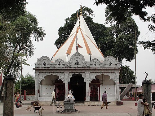
Mahabhairav Temple & Monolithic Linga Citadel (মহাভৈৰৱ মন্দিৰ, তেজপুৰ) (Tezpur, Sonitpur District, Assam)
Jogighopa Rock-Cut Caves / Pancha Pandava Caves (যোগীঘোপাৰ শৈল গুহা)
Eighth-to-Eleventh Century Kamarupa Monolithic Rock-Cut Meditation Cells & 17th-Century River Bastion on the Brahmaputra (ASI Code N-AS-65)
Eighth-to-Eleventh Century Kamarupa Monolithic Rock-Cut Meditation Cells & 17th-Century River Bastion on the Brahmaputra (ASI Code N-AS-65)
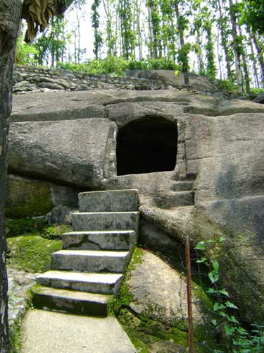
Jogighopa Rock-Cut Caves / Pancha Pandava Caves (যোগীঘোপাৰ শৈল গুহা) (Jogighopa, Bongaigaon District, Assam)
Biswanath Ghat & Gupta Kashi Temple Cluster (বিশ্বনাথ ঘাট আৰু গুপ্তকাশী মন্দিৰ সমূহ)
Submerged Bedrock Biswanath Shivalinga, 25+ Riverine Devalayas & 1758 CE Royal Ahom Bordol Temple at the Burhigang-Brahmaputra Confluence (ASI Code N-AS-50)
Submerged Bedrock Biswanath Shivalinga, 25+ Riverine Devalayas & 1758 CE Royal Ahom Bordol Temple at the Burhigang-Brahmaputra Confluence (ASI Code N-AS-50)

Biswanath Ghat & Gupta Kashi Temple Cluster (বিশ্বনাথ ঘাট আৰু গুপ্তকাশী মন্দিৰ সমূহ) (Biswanath Ghat (Biswanath Chariali), Biswanath District, Assam)
Badarpur Riverine Frontier Fort (বদৰপুৰ দুৰ্গ, কৰিমগঞ্জ)
Eighteenth-to-Nineteenth Century Brick-and-Lime Artillery Bastion on the Barak River in Karimganj District
Eighteenth-to-Nineteenth Century Brick-and-Lime Artillery Bastion on the Barak River in Karimganj District
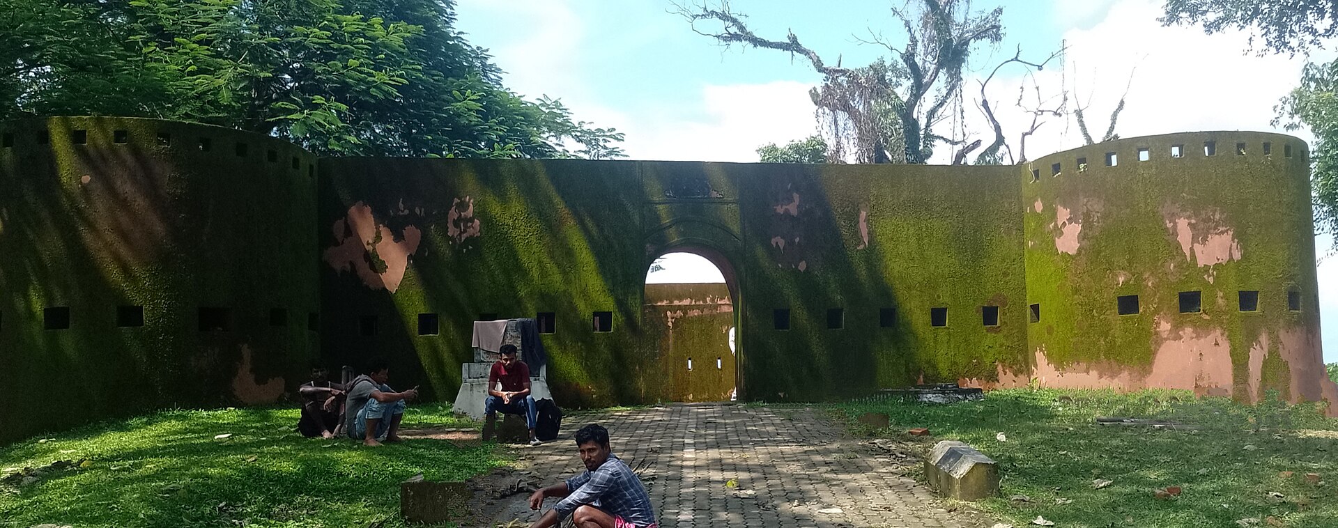
Badarpur Riverine Frontier Fort (বদৰপুৰ দুৰ্গ, কৰিমগঞ্জ) (Badarpur Ghat, Karimganj (Sribhumi) District, Assam)
Garh Ali, Dhodar Ali & Ahom Rampart Highway Network (গড় আলি আৰু ধোদৰ আলি — আহোম সামৰিক পথ আৰু গড়)
Seventeenth-to-Eighteenth Century Ahom Compacted-Earth Military Embankment Highways & Moated Frontier Garhs Across Assam
Seventeenth-to-Eighteenth Century Ahom Compacted-Earth Military Embankment Highways & Moated Frontier Garhs Across Assam
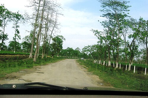
Garh Ali, Dhodar Ali & Ahom Rampart Highway Network (গড় আলি আৰু ধোদৰ আলি — আহোম সামৰিক পথ আৰু গড়) (Jorhat, Golaghat, Sivasagar, Charaideo & Dibrugarh Districts, Upper Assam)
Archaeological Stewardship & Open Access Ethics
All cultural documentation presented in this exhibit adheres to ethical preservation charters. Field imagery and research notes are published in cooperation with local community custodians, temple sattras, and regional historians. Where archival media is sourced from institutional commons, verified Creative Commons deeds (CC BY-SA 4.0, CC0, or Public Domain) are honored with full attribution.
Explore adjacent collections in the Assam Hall of Monuments or visit the Assam State Wing to discover the complete civilizational tapestry of the Brahmaputra valley.